
When was the last time you used a physical, printed map? No zooming in and out, no street view, no search boxes. I absolutely love geography and the physical sciences so I find maps fascinating. If you don’t, National Geographic’s Visual Atlas of the World may just change your mind…
Visual Atlas of the World
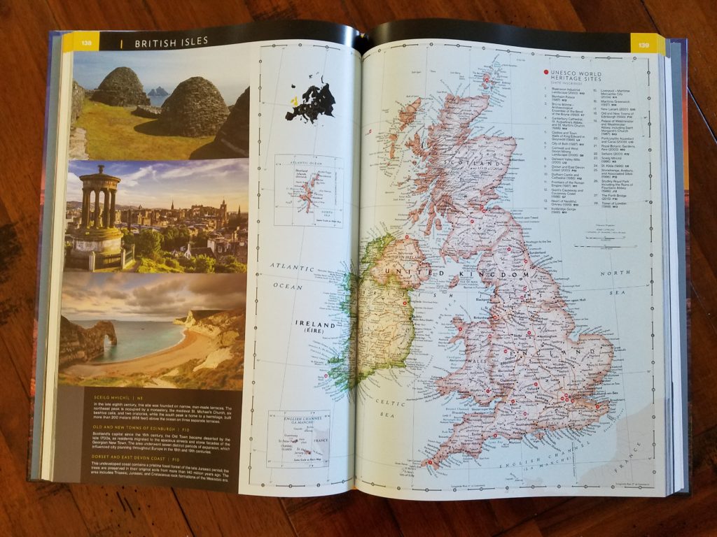
Content: This beautiful tome provides political, physical and thematic maps for each continent, the poles and each ocean. It further breaks down each area into regions that allow for detailed imagery and information. Also included are an entire section on outer space and a discussion of flags and facts regarding countries, territories and dependencies across the globe. The opening portion of the book provides information on how to read and understand the features on the map styles used including symbols, features and index organization.
Within each more detailed regional chapter, there are stunning photographs accompanying facts discussing local cultural and historical sites. The chapters also relay continental facts and maps varying from water availability and natural hazards to energy consumption and climatic zones.
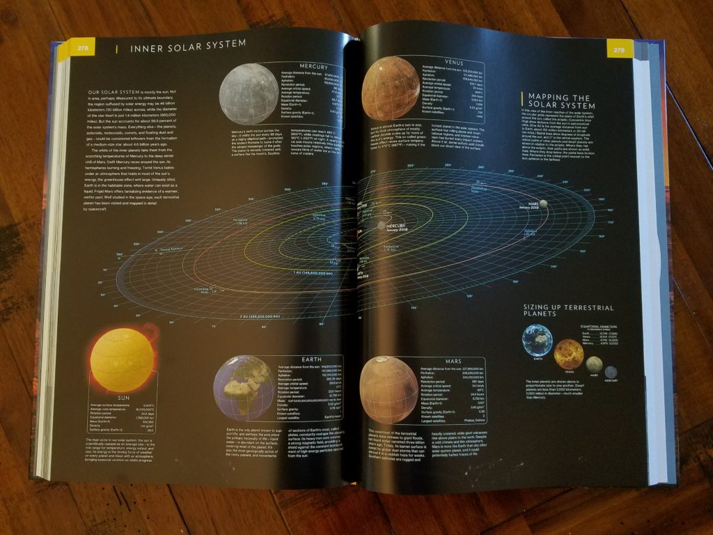
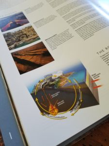
Opinion: This book was a bit intimidating at first! It is a gorgeous oversized, hardcover reference book with luscious images and glossy pages, but it is chock full of information! The first 80 pages or so of the work were by far my favorite as they discuss the general history of Earth from a geological perspective and provide a look at the planet’s construction. There are also more intricate discussions of rock formations, plate tectonics, landform creation, water constitution, wind patterns, sea levels, weather formations, population growth and diversity, ecology, regional food, and MORE!
I love geography and the physical sciences which made all of these topics fascinating to read about! None of these items were discussed in depth, but provide a wonderful introduction to whet the appetite for further study. Not to mention it seems like every item has a prize-winning photography and/or infographic or diagram to illustrate the information.
Recommendation: This is a book for explorers – both those who physically travel the globe and those that let the pages of books take them on incredible adventures. It is also perfect for a household with science-minded students of any age. For general reference or extended geographical studies, this book is a valuable tool for understanding the world we live on. It is an investment to be sure, but I would still recommend it as it is so much easier to immerse oneself in the information when you can tangibly hold the volume. Even with only occasional use, it would be an excellent choice for coffee table decor!
Special thanks to TLC Book Tours for the book in exchange for my honest review!
Oh, and I have Bachelors degree in Journalism and Masters' degrees in Business and Sports Administration that I like to flex via blogging here and handling digital content for a local yarn shop!
- If You Liked Off Campus, Here’s What to Read Next - July 13, 2026
- Review: A Botanist’s Guide to Tradition and Treachery by Kate Khavari - June 2, 2026
- Review: Through the Snow Globe by Annie Rains - August 29, 2023
4 comments
[…] Tuesday, November 6th: Literary Quicksand […]
This book is absolutely gorgeous! Thanks for being on the tour!
[…] those of us interested in learning more about WWII. I recently reviewed National Geographic’s Visual Atlas of the World, and while the topic of the Atlas of WWII is more focused, the breadth of content is almost equally […]
What feature is on the cover?